Street View
Roadside approach
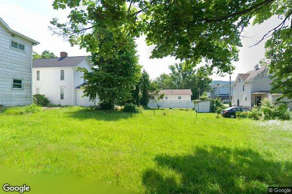
Use this for frontage, access, neighboring uses, and what a buyer will actually see from the road.
Parcel dossier
GPS: 40.335856, -79.304312 - DERRY BOROUGH TWP, PA
Core dossier fields are present.
Street-level context now shows up on the default dossier view instead of hiding behind the GIS tab.
Use this for frontage, access, neighboring uses, and what a buyer will actually see from the road.
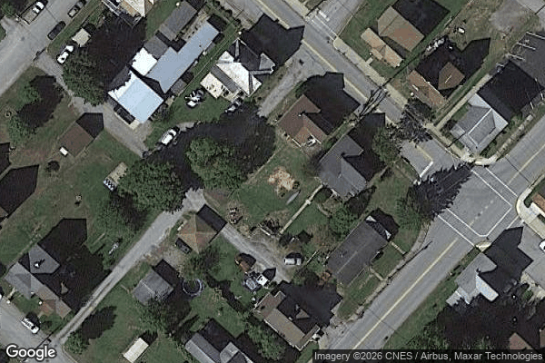
Keep the overhead read nearby for lot shape, adjacency, canopy, and how the road lines up with the parcel.
Best for sanity-checking ingress, frontage, neighboring conditions, and what the site reads like at ground level.
Use the aerial read for lot shape, surrounding lots, canopy coverage, and how the tract sits against the road network.
PA-specific due diligence items generated from this parcel's data. Items marked critical must be resolved before closing.
One-click searches built from this parcel's owner name, parcel ID, and municipality. Each opens a targeted Google query or PA public records portal.
No obituary or public web signals captured for this owner.
No evidence signals collected yet. Run a pipeline refresh to gather listing, comp, and web signal data.
Well-positioned edge-of-town buildable lot with easy access to Derry services and major road corridors, likely most attractive to traditional homesite buyers.
Nearby: Keystone State Park (2.7 mi), Loyalhanna Lake (7.7 mi), Linn Run State Park (12.9 mi)
Data sources: pipeline_gis, camino_api | Assessed: 2026-04-21T11:56:35
Structured buy / pass evaluation for this parcel.
Last refreshed: - | Refresh count: 0
Holdings reuses the same source-backed research outputs and keeps citations attached.
Ledger total: $0.00
No expense items yet.
No search results saved yet.
No notes yet. Add one above.